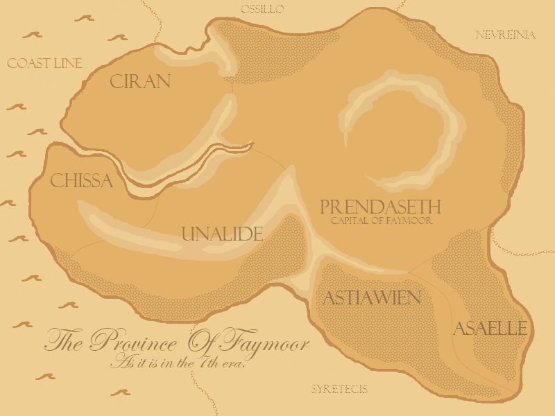
I introduce the map of the province of Faymoor.
I spent quite a bit of time on this and will so explain.
The whole thing is Faymoor. The sections of the landmass that are split by mountain or dotted line are territories. Each territory will eventually have it's own capital city(sort of sub capitals). Prendaseth is the capital province, and therefore is home to the overall capital city. On the map lightened areas indicate higher than ground level and darkened dotted areas represent forested areas. I think that explains everything.
If you have any questions about the map please ask and share your thoughts.